Scenic and typographic atlas title page engravings
and lithographs from the Rumsey Map Collection
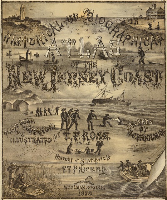
Title: Historical and biographical atlas of the New Jersey coast
Author: TT Price, TF Rose; HC Woolman
Date: 1878
Notes: Illustrated lithographed title page. This is an outstanding combination of maps, views, and historical text. It is in the "county atlas" style of the period, but the choice of area (the New Jersey sea coast spanning several counties) is unusual. Maps hand painted and printed in full colour.
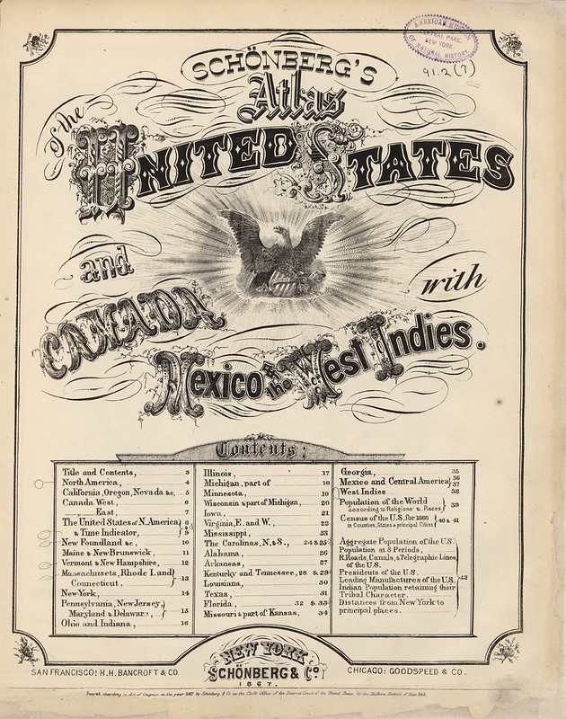
Title: Title Page and Index Page: Schonberg's Atlas of the United States, Canada, Mexico & the West Indies
Author: Schonberg & Co.
Date: 1867
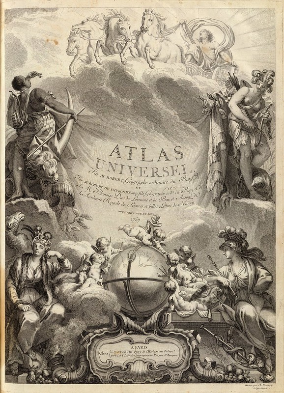
Title: Atlas Universel, Par M. Robert Geographe ordinaire du Roy, et Par M. Robert De Vaugondy son fils Geographe ord. du Roy, et de S. M. Polonoise, Duc de Lorraine et de Bar, et Associe de L'Academie Royale des Sciences et belles Lettres de Nancy, Avec Privilege Du Roy, 1757
Author: Gilles Robert de Vaugondy
Notes: 1st edition, with five postal maps added, as issued. With the list of subscribers and the extra postal maps of England, France, Germany, Italy and Spain. The French postal map is dated 1758. All five were added after the printed list of maps was printed, but are mentioned by Vaugondy in the preface, so they may have been an afterthought.
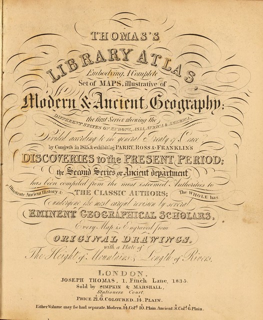
Title: Thomas's library atlas, embodying a complete set of maps, illustrative of modern & ancient geography ... London, Joseph Thomas, 1, Finch Lane, 1835. Sold by Simpkin & Marshall, Stationers Court
Author: R Fenner; Publisher: J Thomas
Notes: Reissue of Fenner's Pocket atlas of 1830.
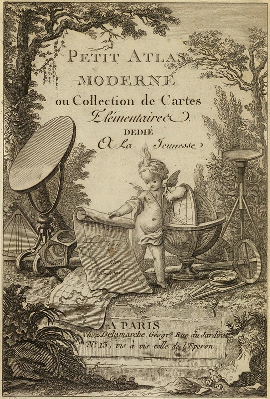
Title: Petit atlas moderne ou collection de cartes elementaires dedie a la jeunesse. A Paris, chez Delamarche, Geogr., Rue du Jardinet No. 13, vis a vis celle de l'Eperon
Author: Charles Francois Delamarche; Jean Lattre
Date: 1800
Notes: Engraved illustrated title page showing cherub with globe, maps, surveying instruments, etc. Called "Frontispice" in table of contents. N. America and Etats Unis dated 1783. Originally published by Lattre in 1763, this and later editions were published by Delamarche.
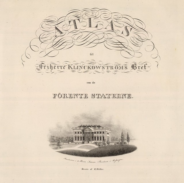
Title: Atlas til Friherre Klinckowstroms Bref om de Forente Staterne
Author: Axel Leonhard Klinckowstrom; Publisher: C. Muller, Stockholm
Date: 1824
Notes: View on title page: Presidentons i de Forente Staterna recidence i Washington.
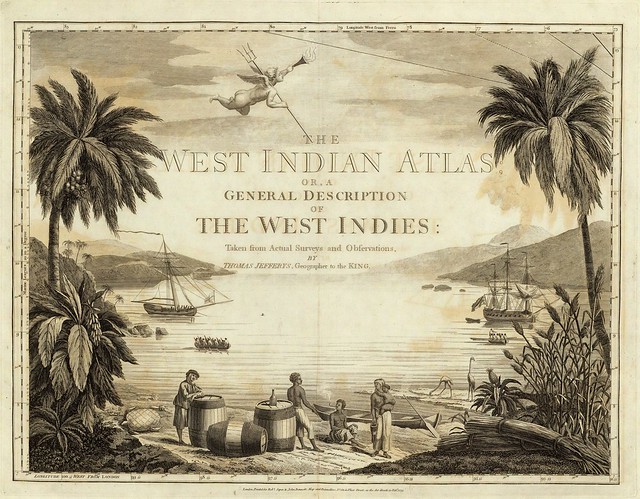
Title: West-India atlas: or, a compendious description of the West-Indies
Author: Thomas Jeffreys
Date: 1788
Notes: This is a superb atlas of the West Indies and a companion atlas to Jeffery's American Atlas also first issued in 1775. The latest date on the charts in this copy is 1788 (The Cape Verd Islands). There is a beautifully illustrated title page that precedes the main title page, which reads "The West Indian Atlas..." Jefferys died in 1771; Sayer and Bennet acquired his materials in preparation for this atlas, and published the atlas posthumously under his name (as they did with the American Atlas) in 1775.
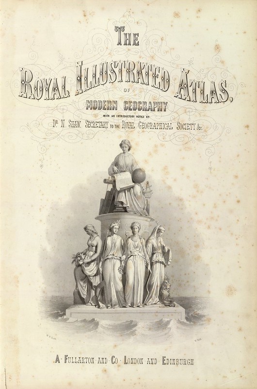
Title: The Royal Illustrated Atlas, Of Modern Geography With An Introductory Notice By Dr. N. Shaw, Secretary To The Royal Geographical Society &c
Author / Publisher: A Fullerton & Co. London & Edinburgh
Date: 1872
Notes: 1st edition 1864; published in 27 parts 1854-62. The date of 1872 is estimated by the Australia map; all the maps are undated and probably date throughout the period 1864 to 1872. This is the last highly decorative atlas published in England. Even the maps without views or figures are beautifully engraved and coloured with a mixture of printed colour and hand colour. Swanston, Petermann, Bartholomew, McNab and Johnson engraved the maps.
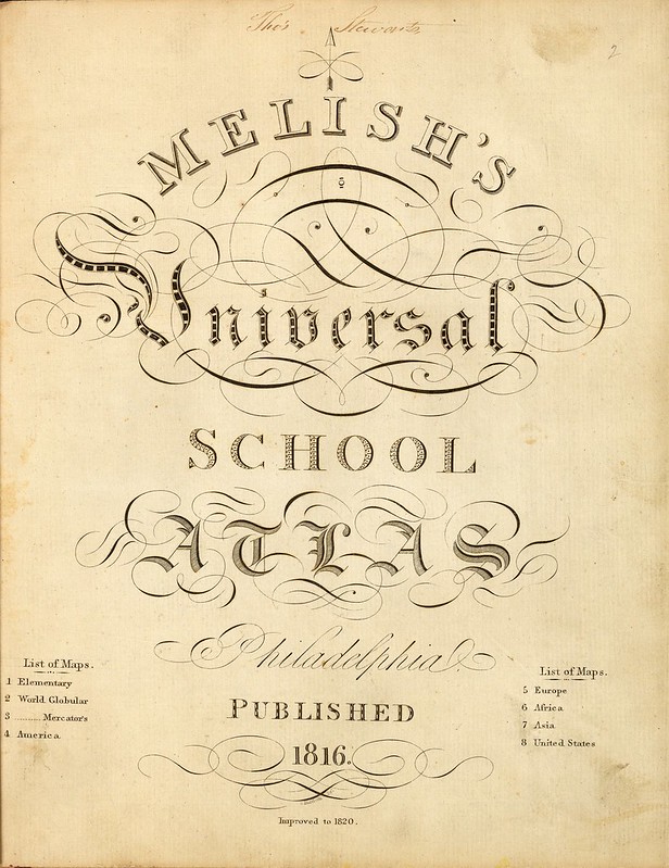
Title: Melish's Universal School Atlas
Author / Publisher: John Melish
Date: 1820
Notes: The third edition, complete with eight outline colour maps. Rare. With marble covered half-leather boards and "School Atlas" imprinted on spine.
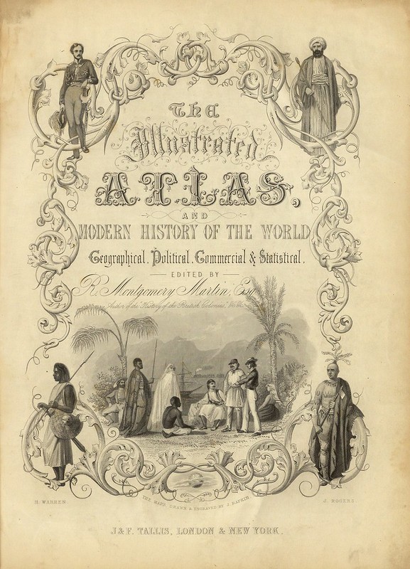
Title: The Illustrated Atlas, And Modern History Of The World Geographical, Political, Commercial & Statistical
Author: RM Martin; J&F Tallis
Date: 1851
Notes: Hand-coloured maps by J. Rapkin. Earlier editions have a second title page dated 1851, a view of the Great Pavilion opposite the ornamental title page, and an index sheet titled "Directions to Binder - arrangement of maps".
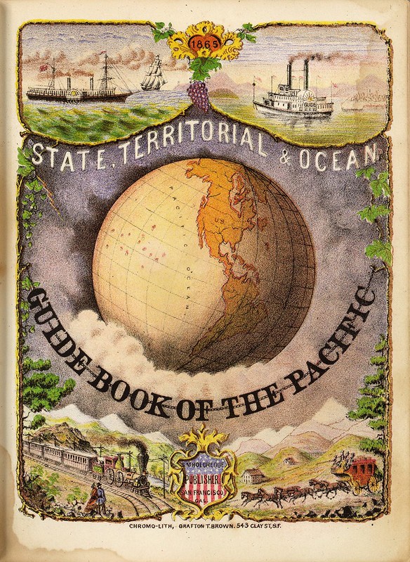
Title: State, territorial and ocean guide book of the Pacific
Author: Sterling M Holdredge
Date: 1866
Notes: With a beautiful chromo litho title page illustrated with a globe showing the western hemisphere. Transportation scenes surround globe, including ships, a riverboat, train, and stagecoach. The nine maps are all double page and full of interesting information. They were lithographed by Grafton T. Brown, the first black lithographer in San Francisco.
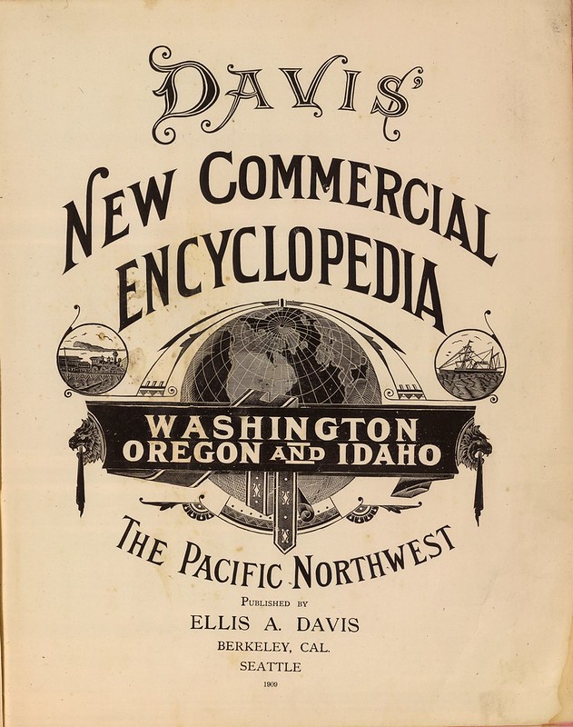
Title: Davis' new commercial encyclopedia, the Pacific Northwest: Washington, Oregon and Idaho
Author / Publisher: Ellis Arthur Davis
Date: 1909
Notes: Atlas begins with an explication of the three featured states along with pictures and uncoloured maps. This is followed by full colour maps of the United States and the world. Most maps are by GF Cram.
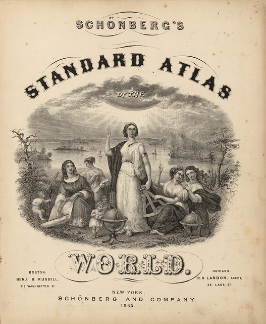
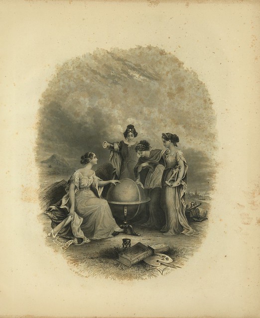
Title: Schonberg's Standard Atlas Of The World
Publisher: Schönberg & Co. New York
Date: 1865
Notes: Includes a captivating large vignette with a radiant sun and five women and three cherubs with the instruments of geography (sextant, globes, map, telescope, notebook, etc.). The landscape is wild with trees, islands, and rugged topography. Ships of various types also shown.
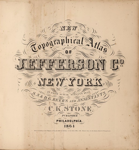
Title: New Topographical Atlas of Jefferson County, New York
Author: SN & DG Beers
Date: 1864
Notes: The first county atlas produced by the Beers family.
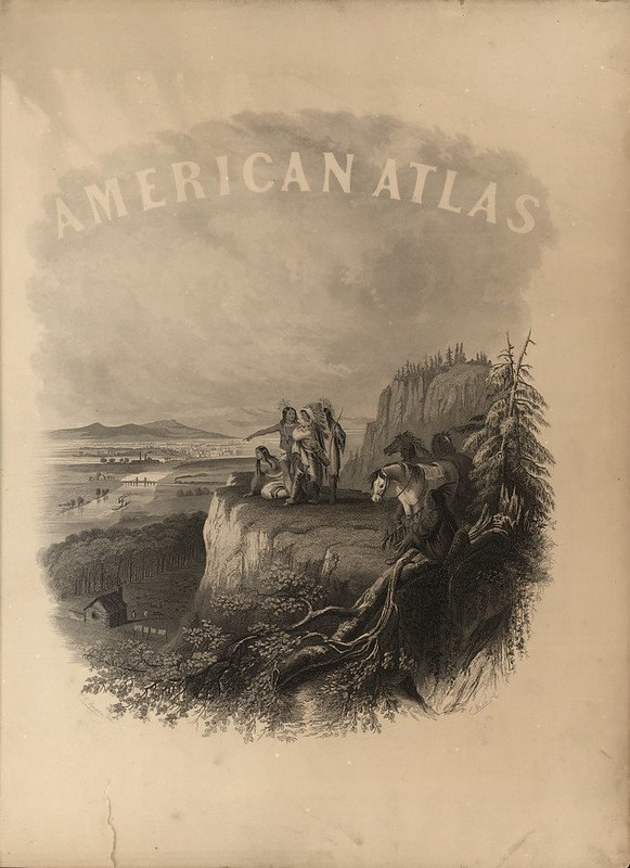
Title: Johnson's New Illustrated (Steel Plate) Family Atlas
Author: AJ Johnson
Date: 1860
Notes: [Half-]Title on page reads "American Atlas" and is accompanied by an illustration of Indians on a bluff overlooking a river, town and homestead. Most of the maps come from Colton's 1859 edition of the General Atlas, published by Johnson and Browning.
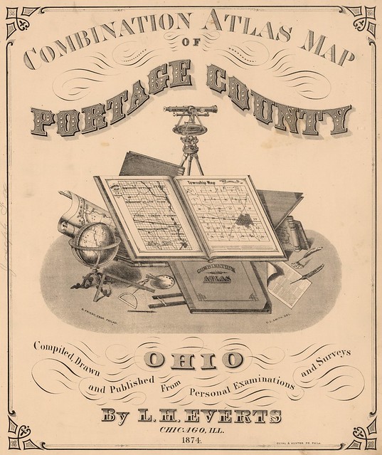
Title: Combination Atlas Map Of Portage County Ohio. Compiled, Drawn and Published From Personal Examinations and Surveys
Author: LH Everts
Date: 1874
Notes: Includes large vignette with the tools of cartographers and surveyors. Everts was Thompson's partner in early 1870's. There are similarities between this atlas and Thompson's atlases of California counties, due to his earlier partnership with Everts. Many views and portraits. Full colour.
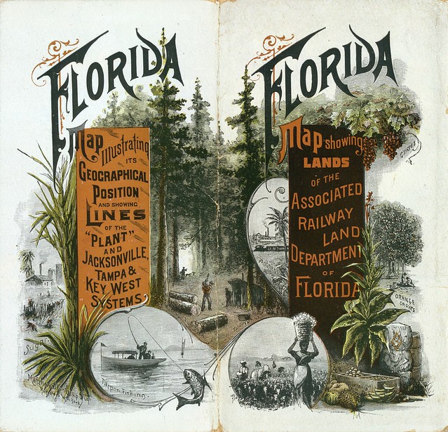
Title: Front Cover: Township map of Peninsular Florida issued by the Associated Railway Land Department of Florida & Back Cover: Florida: map illustrating its geographical position of the "Plant" and Jacksonville, Tampa & Key West systems
Publisher: D.H. Elliott, General Land Agent, Associated Railway Land Department of Florida
Date: 1890
Notes: With illustrated covers and title page. The Associated Railway Land Department of Florida was composed of four railway companies and two land development companies that, as a group, controlled what appears on the map to be half the land in the state. A 36 page written essay by D.H. Elliott explains the agricultural potential of the lands offered for sale.
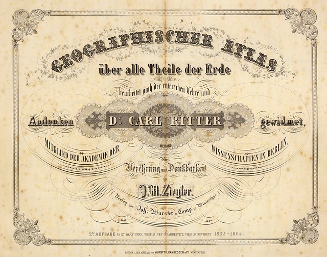
Title: Geographischer Atlas uber alle Theile der Erde
Author: JM Ziegler & Carl Ritter
Date: 1864
Notes: The maps are numbered 1-26 and are undated. They are with hand or printed colour, in a mixture of outline and full colour. Covers are brown marbled paper covered boards with an untitled paper label and new blue cloth spine.
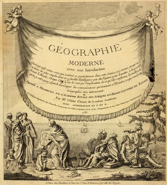
Title: Geographie moderne avec une introduction. Ouvrage utile a tous ceux qui veulent se perfectionner dans cette science ... Dediee a Messieurs de l'Academie Royale des Sciences et Belles-Lettres de Rouen. Par Mr. l'Abbe Clouet de la meme Academie avec approbation et P. du R. Corrigee et augmentee des nouvelles decouvertes du celebre Capitaine Cook et des changements arrives dans l'Amerique Septentrional.
Author: Jean-Baptiste Louis Clouet
Date: 1787
Notes: This is an unusually thorough teaching atlas for the period: each map has marginal text on both sides which explains the function of the map -- topographical, historical, political, etc. Because of its comprehensiveness, this atlas must have been used by advanced students of geography.
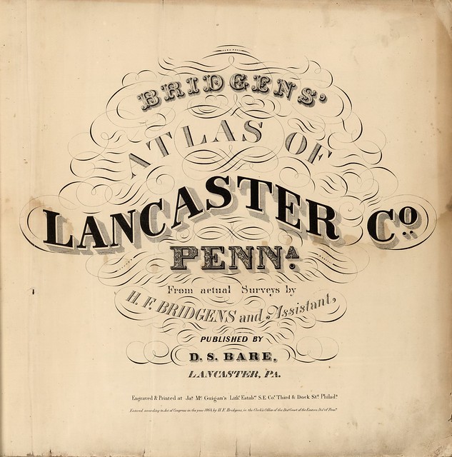
Title: Bridgens' Atlas Of Lancaster Co., Penna. From actual Surveys by H.F. Bridgens and Assistants, Published By D.S. Bare, Lancaster, Pa. Engraved & Printed at Jas. McGuigan's Lithc. Estabnt. S.E. Cor. Third & Dock Sts. Philada. Entered ... 1864, by H.F. Bridgens ... Penna.
Date: 1864
Notes: 2nd county atlas published in the United States. Very different from the Beers family productions; elegant cartography. Full hand painted colour.
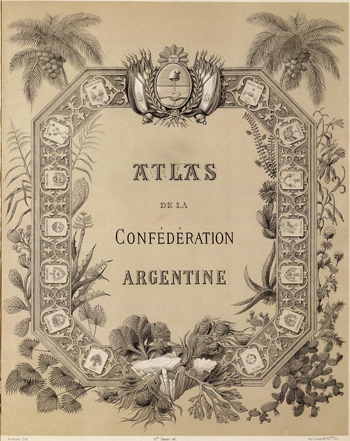
Title: Atlas de la Confédération Argentine
Author: Victor Martin de Moussy
Date: 1873
Notes: This was the first atlas of Argentina. A beautifully engraved title page precedes the full title page and reads "Atlas de la Confederation Argentine. Bachelier Lith. Gve. Sanier, del. Imp. Lemercier & Cie. Paris." Most of the maps are without colour; a few are hand painted in full colour.
Half-Title to Colton's Atlas Of The World, Illustrating Physical And Political Geography, Accompanied By Descriptions Geographical, Statistical, And Historical
Author: GW Colton
Date: 1856
Notes: This atlas was the first world atlas produced by Colton, after many years of issuing pocket maps, wall maps, guides, and maps for books. The atlas was one of the finest and most accurate of the period - it had a long publishing run, continuing for over thirty years.
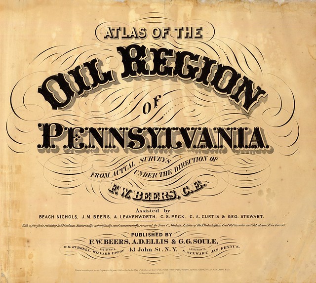
Title: Atlas of the oil region of Pennsylvania. From actual surveys under the direction of F.W. Beers, C.E. With a few facts relating to petroleum, historically, scientifically, and commercially, reviewed by Ivan C. Michels, Editor of the Philadelphia Coal Oil Circular and Petroleum Price Current.
Author: FW Beers
Publisher: Beers, Ellis, & Soule, New York
Date: 1865
Notes: The only regional atlas made of the oil regions in Pennsylvania and probably the most complete and detailed mapping done at the time -- it is far more detailed than the general maps that appeared in pocket form or separately.
All the notes above derive from the Rumsey site and are closer to quotes than paraphrasing. The images have all been cropped - slightly in most cases - from their respective source files; but are otherwise unaltered.
From the title of this entry you can deduce that there is a previous Atlas Title Page post AND, also, that an Atlas Title Page Redux TWO will be appearing on this site soon enough.
A title page, particularly in the context of a cartographic atlas, is something of a loose term describing variable material within the front matter, or preliminary pages. For our purposes, it may include decorative part-title frontispieces or more formal written pages bearing the full title and identifying information in embellished typeforms.
"The history of the title-page can be traced back to the 1470s. The earliest printed books followed the tradition of manuscript volumes in that a colophon at the end of the work gave details of the contents and the date and place of printing. Therefore, the first printed Ptolemaic atlases do not have a title-page and rely on a colophon for this purpose." [source]
In general, there are said to be five types of title page (often combined): ornamental, compartmental, architectural, pictorial and cartographical. These evolved over a few hundred years and the plates above are mostly from 1850 onwards. The allegorical, religious, heraldic and mythological thematic figures that often dominated earlier title pages, for instance, tended to be reduced or gave way, over time, to decorative elements that had a more practical, informative focus.
Many of the scenes featured in the title pages above (and yet to come!) therefore contain items such as scientific instruments, world globes, evocative location scenes, peoples from distant and/or romantic places and maybe hints of naval strength and imperialism associated with the age of exploration. I'm particularly fond of the diverse typographic forms in many of the titles. The image choice skews towards US locations, mostly for practical reasons. Rumsey's [source] site concentrates on US maps and, as printing became cheaper and more innovative in the mid-to-late 19th century, publishing houses in Philadelphia and New York emerged as prolific and dominant players in atlas production in the world. So the selection is not meant to be a serious overview of the genre; it's more a personal sampling.
- The title page images above all come from the fabulous David Rumsey Cartography Associates Map Collection site.
- From Jonathan Potter Maps of London - Newsletter Issue 8 (June 2009) features an illustrated article by British Librarian map curator, Tom Harper: [~4MB .pdf] 'The Artistic Elements of Atlas Title Pages'.
- The Map Collectors' Circle published monograph articles for 12 years up to 1975. The erstwhile definitive commentary on atlas title pages was included in their final volume: Map Collectors Circle #107: 'Title pages from 16th to 19th Century' by Ronald V Toomey.
- 'The Decorative Cartographic Title' by Rodney Shirley at Kunstpedia: Part One (4 pages) and Part Two (4 pages).
- The current leading authority on atlas title pages is a 2007 book by RW Shirley called, 'Courtiers and Cannibals, Angels and Amazons: The Art of the Decorative Titlepage':---->"[It] examines one hundred important decorative title pages and frontispieces dating from the fifteenth through the nineteenth centuries, analyzing their intricate elements and setting them within the historical contexts of early book printing and the decorative arts. The illustrations range from ornamental art to elaborate images containing complex symbols and allegories and address such diverse topics as cartography, astronomy, and travel. The book also features vibrantly illustrated examples from around the world—including Italy, Germany, Britain, and the United States—and each illustration represents differing techniques in typography, design, and artistic style as they developed over the centuries." [see more via Oak Knoll Press]
- Paulus Swaen Old Maps has a collection of >300 varied atlas title page images.
- Jonathan Potter Maps title pages.
- Previously: the many BibliOdyssey posts featuring material from the David Rumsey site.
- My elsewheres: Pinboard -<>- Delicious -<>- Twitter.
DIGITAL JUICE
No comments:
Post a Comment
Thank's!