This guest post is by Dr. Steffen Fritz, and Ian McCallum, researchers for the International Institute for Applied Systems Analysis, an international research organization that conducts policy-oriented research on global problems.
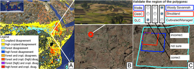
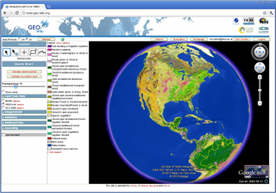
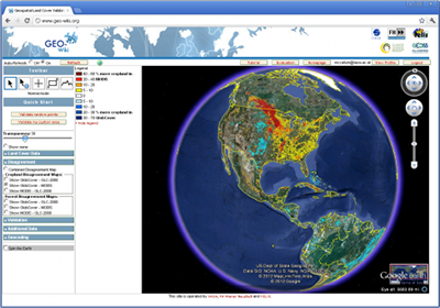
During the last decade, scientists have created several global land cover datasets. Comparison studies show that there are large spatial discrepancies between these products. One reason for these discrepancies is the lack of sufficient ground data for developing and validating these products. To address this issue, we have created the crowdsourcing tool Geo-Wiki.org, a web application using the Google Earth API and Google Earth plug-in. We chose Google Earth largely because of Google Earth’s navigation functionalities, including the ability to adjust the globe’s tilt and see the structure of the Earth’s surface, a significant advantage in recognizing land cover.
In a nutshell, volunteers can:
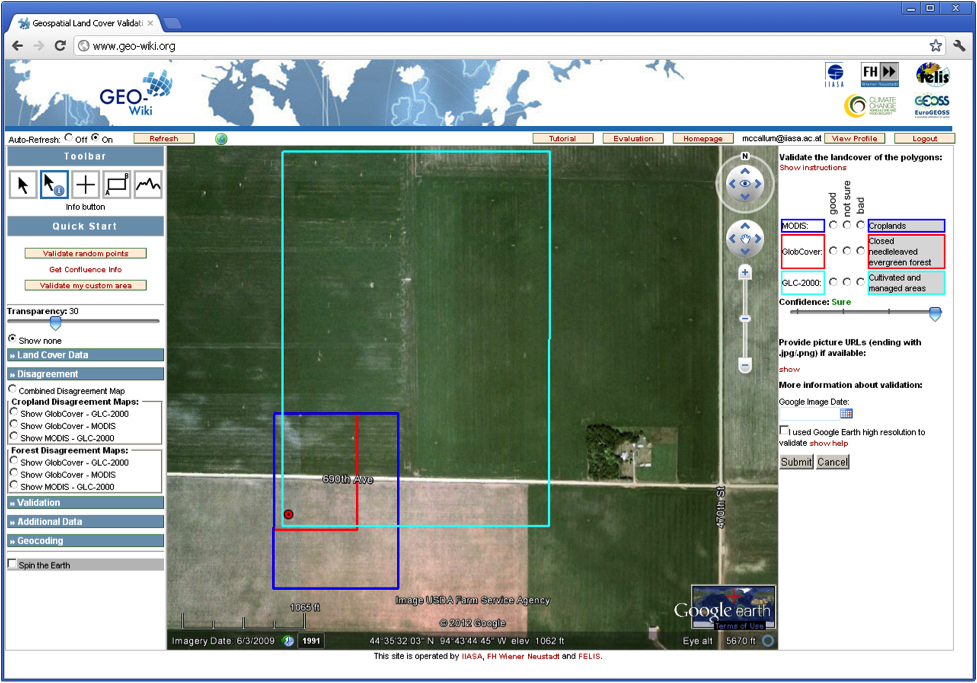
- view disagreement maps derived from three recent global land cover datasets
- select among available high resolution images as well as upload or view geo-tagged pictures (e.g. http://confluence.org), and
- determine which land cover type is found on the ground and decide which dataset is correct.
We record the results in a spatial database.
Geo-Wiki.org adds data to Google Earth in many ways. A MapServer provides raster data that are overlaid above Google Earth imagery using KmlGroundOverlays. Vector data such as current pixel outlines are generated with JavaScript by creating and adding place marks with custom styles. Point data such as members or confluence points are loaded asynchronously as KML and simply added to Google Earth.
One of the main challenges we faced developing Geo-Wiki.org was the rapid handling of the large global datasets we wanted to visualize. To solve this, we chose the open source PostgreSQL relational database with a PostGIS extension to allow for spatial queries. The database stores the user details, user validations and the pixel polygons of the three global land cover data sets. Although the global land cover maps can be viewed as a semi-transparent layer on Google Earth, the bounding coordinates of each pixel are stored in the database. This representation was chosen in order to quickly retrieve the outlines of the pixels and their attributes at any given point on the Earth’s land surface.
In addition to the Google Earth API, Geo-Wiki.org uses the following technologies: Apache2 web server, PHP 5.2, MapServer, GeoServer, GDAL/OGR, PostgreSQL+PostGIS, JavaScript/AJAX.
We have recently launched a Geo-Wiki.org competition to raise awareness of the tool and to encourage community involvement in environmental monitoring.
DIGITAL JUICE
No comments:
Post a Comment
Thank's!